Who doesn’t want to go to Giggle Hollow? This delightful-sounding place can be found between Pine Hill and the south-eastern edge of Belleayre Ski Mountain, in a small web of hiking trails that leads from the top of the ski mountain all the way down to Big Indian wilderness and beyond. In the winter, these Belleayre trails are the perfect destination to snow shoe to these gob-smacking views if you’re with non-skiers or your dog.
If you do take your country dog, he must be harnessed and leashed if he’s likely to become uncontrollably excited by the prospect of skiing and keenly propose the notion of exploring the double black diamonds to a chorus of “Hi, Puppy!” as the skiers glide by. You don’t want your dog flying off down the mountain. While we were admiring the view from the summit, which is the end of the trail, we were approached by a skier from Europe who made me fiercely jealous by telling me that in The Alps skiers take their dogs, who follow them up the mountain on foot underneath the ski lifts. Alpine skiers ski with their dogs. What a life for an outdoor dog. Perhaps we could have Dog Day on Belleayre? Or would that descend into chaos?
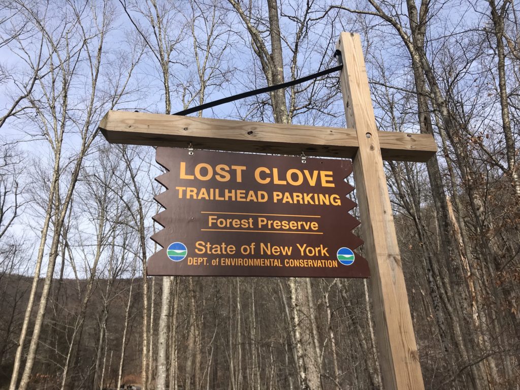
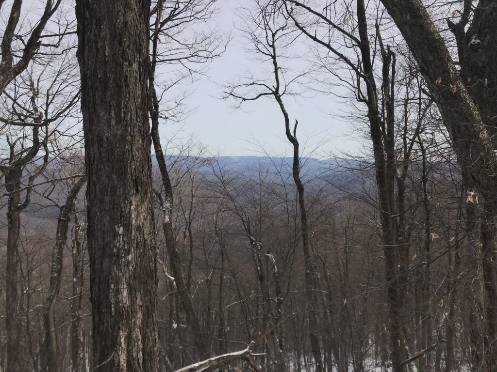
The hike up the side of a ski mountain is as steep as you would expect it to be, with the first 1.3 miles up the Lost Clove trail (blazed red), from Lost Clove Road, towards the summit of Belleayre being an unrelenting trudge at a 45-degree angle. On a wet, winter day with its soggy carpet of leaves, it might be too slippery and too steep to allow the hiker to remain upright. On an icy day, crampons are a necessity and towards the summit you’ll need snow shoes. Carry snow shoes by binding them to the outside of your pack with a bungee cords. The elevation gain is about 1250 feet in those 1.3 miles, but on a winter’s day through the bare trees, the view of Big Indian Wilderness and beyond, rising behind you in the distance is a stunning sight. This will take your mind off the extra weight of the snow shoes.
At the end of the Lost Clove Trail, you’ll meet the Pine Hill West Branch (PW) trail that snakes from Pine Hill all the way down through the Big Indian Wilderness.
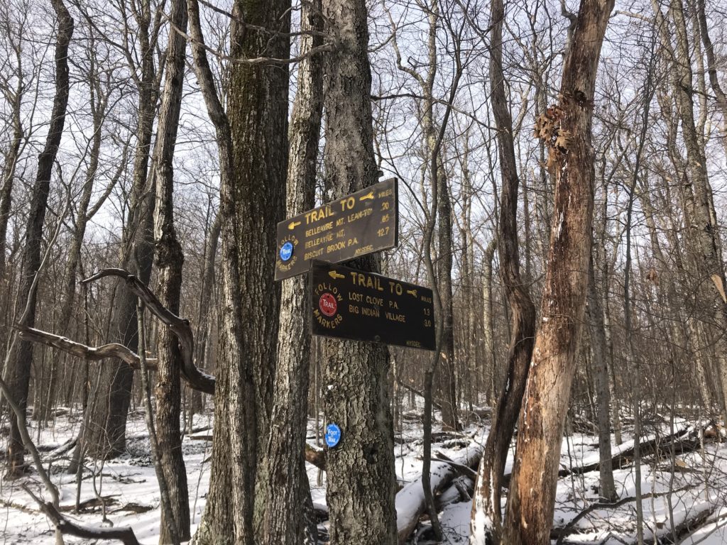
Go west on the PW for 0.85 miles (blazed blue), past the lean-to:
As you climb this part of the trail, you’ll see some more spectacular views.
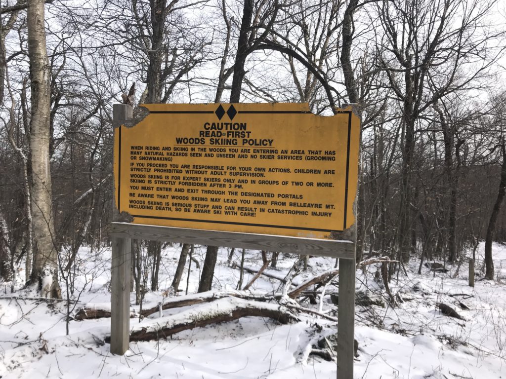
Continue to the site of a grassy clearing where a former fire tower once graced the mountain. At this clearing, to reach the summit of Belleayre you must leave the PW trail and take a right to follow the red blazed trail for a mile to the summit of Belleayre. This is a wide, logging road and used to be part of the cross-country skiing on Belleayre, but the sign below is a possible indicator of why these ski trails were retired.
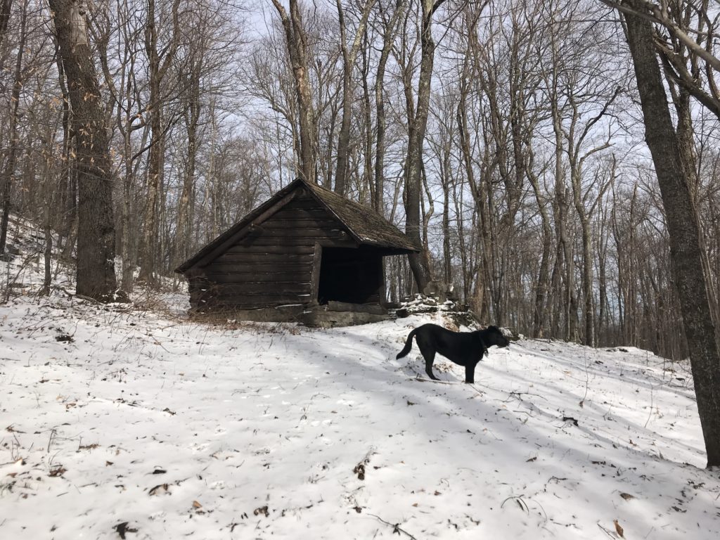
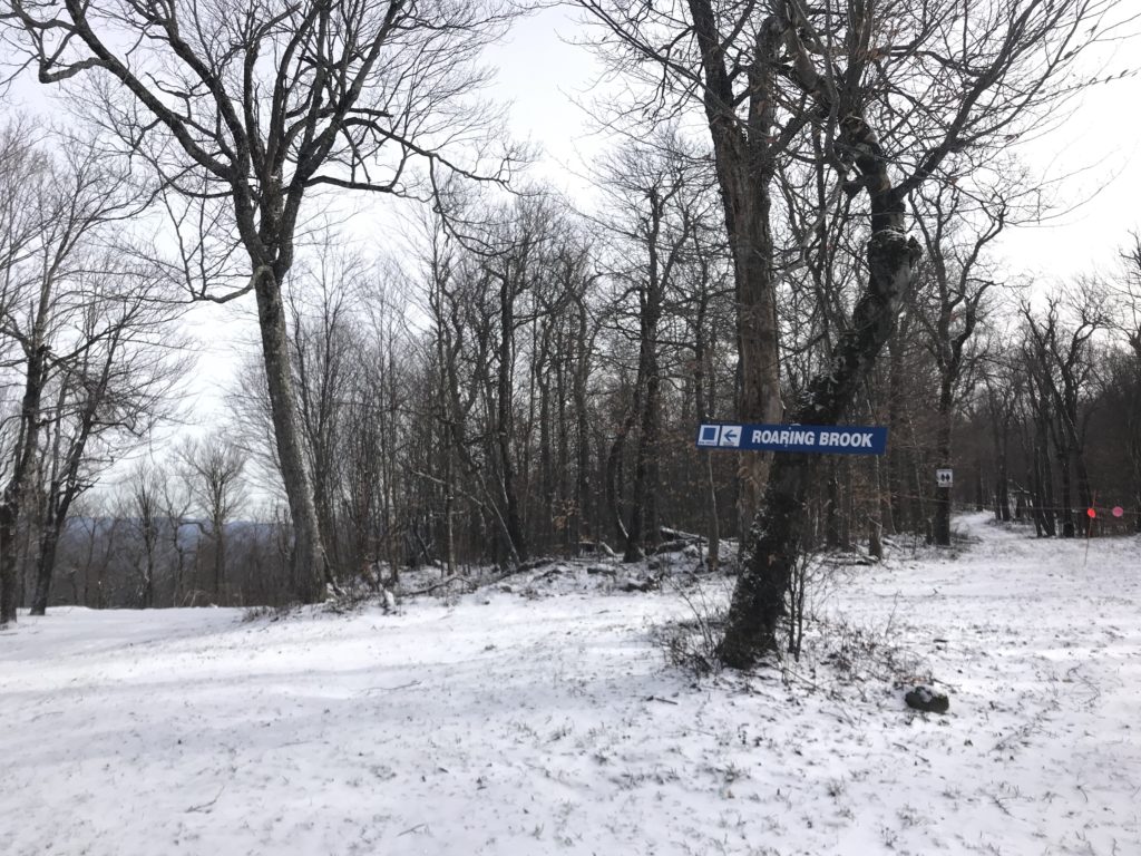
After half mile you’ll see a mess of old picnic tables grown over by a copse of trees behind the Roaring Brook blue run. There’s also another lean-to near the top of the old Cathedral Run, which is stocked with wood.
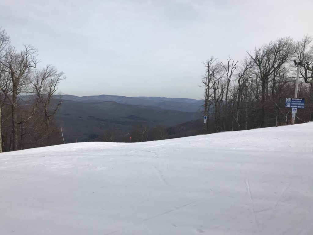
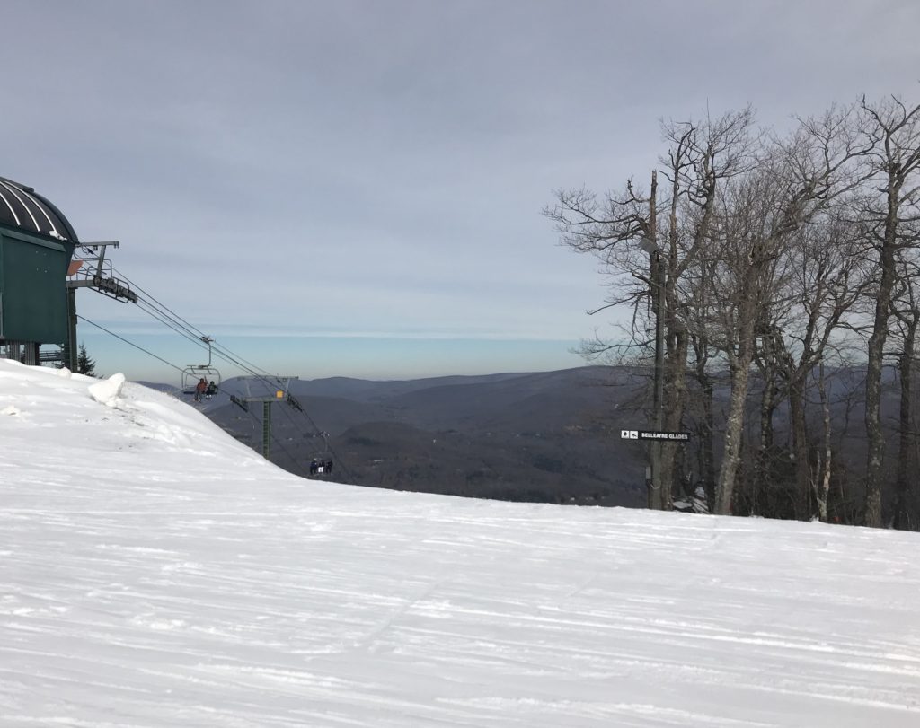
Suddenly, here you’re an interloper behind the scenes on all the action at the top of the mountain. You’ll hear the unmistakable swish of skiers as they pass by in the clearing behind the forest. In the quiet stillness at the top of the mountain, at the end of the trail, we ate our sandwich and watched the skiers drop like stones over the edge of the double black diamonds, like Winnisook and Belleayre, which incited a severe case of the wobblies.
There’s much to see on this mountain. It’s one of the more fabulous hikes, not forgetting that there are three other trails to be explored, like the blue blazed Cathedral Glen that winds north down the front of the mountain to Pine Hill almost parallel to the actual ski-run; the top of the PW trail and, of course, the trail that skirts Giggle Hollow and ends at the covered bridge in Pine Hill. To fully explore this gorgeous little corner of the Catskills, take two cars and park one in Pine Hill and one at the Lost Clove parking area, saving your group the obligation of making the return journey over this steep mountain. Or, if you’re hiking alone, have a friend pick you up in Pine Hill and return you to your car.
Find this hike on Map 142 of the Central Catskills Trails Maps by the NYNJ Trail Conference.
I’m going to get in shape and try this hike!