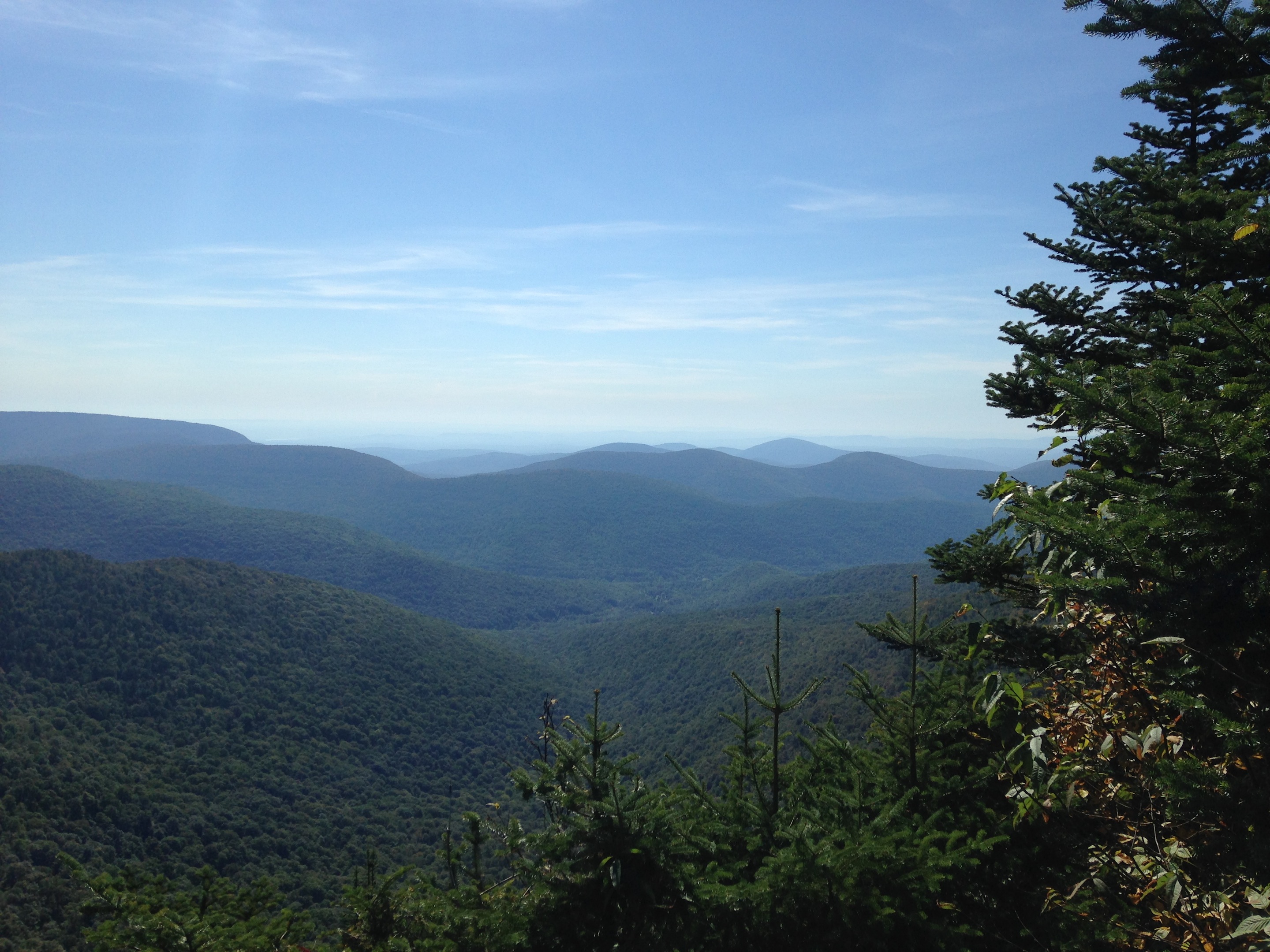
© J.N. Urbanski The view from Buck Ridge Lookout
It might have been the delirium caused by hiking two miles up a steep, rocky mountain in less than an hour, but I couldn’t find the summit sign of Westkill after having gone past the two lookout points by about half a mile. If it is indeed there, I could not find it.* Could people stop stealing summit signs please? It’s dangerous for hikers, who go much further than they had planned, looking for something that’s not there, and tire themselves out. After looking for the summit sign for 15 minutes, I turned around on the trail intending to make my descent to my car. I stopped at Buck Ridge Lookout for a few minutes’ rest, but when I went to leave, I could not find the trail back and, as usual, deferred to the dog for guidance. He always trots ahead on every hike, can smell the trail and never goes wrong. This time, however, because this summit is in the middle of a trail that continues onward, he decided that we should just continue back the wrong way on that trail, which was five miles to another parking area on Spruceton Road that was four miles from the car. When I realised that was his plan, I panicked. He froze, staring back at me in anticipation as I traipsed around in the wilderness looking for the red blaze to direct us back the correct way. First time on The Devil’s Path and I was lost, however briefly, despite my good intentions.
The lesson learned here is not to hike in a hurry. Always try and remember what the trail looks like if you are hiking a path on which you plan to turn around and go back the way you came. Frequently looking back and taking a quick snap with the phone on the ascent is a good idea. Take pictures of all the mile markers and signs for later reference. What I hadn’t noticed on my ascent to Westkill is that Buck Ridge Lookout is right on the trail and its ledge appears after you clamber up past a tree stump that you can grab to pull yourself up. Then you go through a bush and, suddenly you’re on top of the world, taking in astonishing views. On all the hikes I’ve climbed, lookout ledges are metres from the trail, but if you want to return down the way you came from the Buck Ridge ledge, the red blaze is immediately to the left of the ledge if you are looking out over the mountains. The trail is obscured by the brush. From the ledge, you can see Hunter Mountain fire tower and ski area.
To hike to the Westkill summit, get to the trailhead by taking Route 42 from Route 28; turn right on Spruceton Road and drive all the way to the end. There’s nowhere to sign in for this hike, so if you’re hiking alone, let someone know. There’s a metal gate that’s easily visible from the parking area; that’s the trailhead. I got a few bars of cell service at the summit of Westkill, but don’t rely on that.
The first mile along Diamond Notch (blazed blue) is a serene walk alongside a roaring brook that culminates at Diamond Notch Falls, possibly the most picturesque scene on a misty summer’s morning that I’ve ever seen.

© J.N. Urbanski
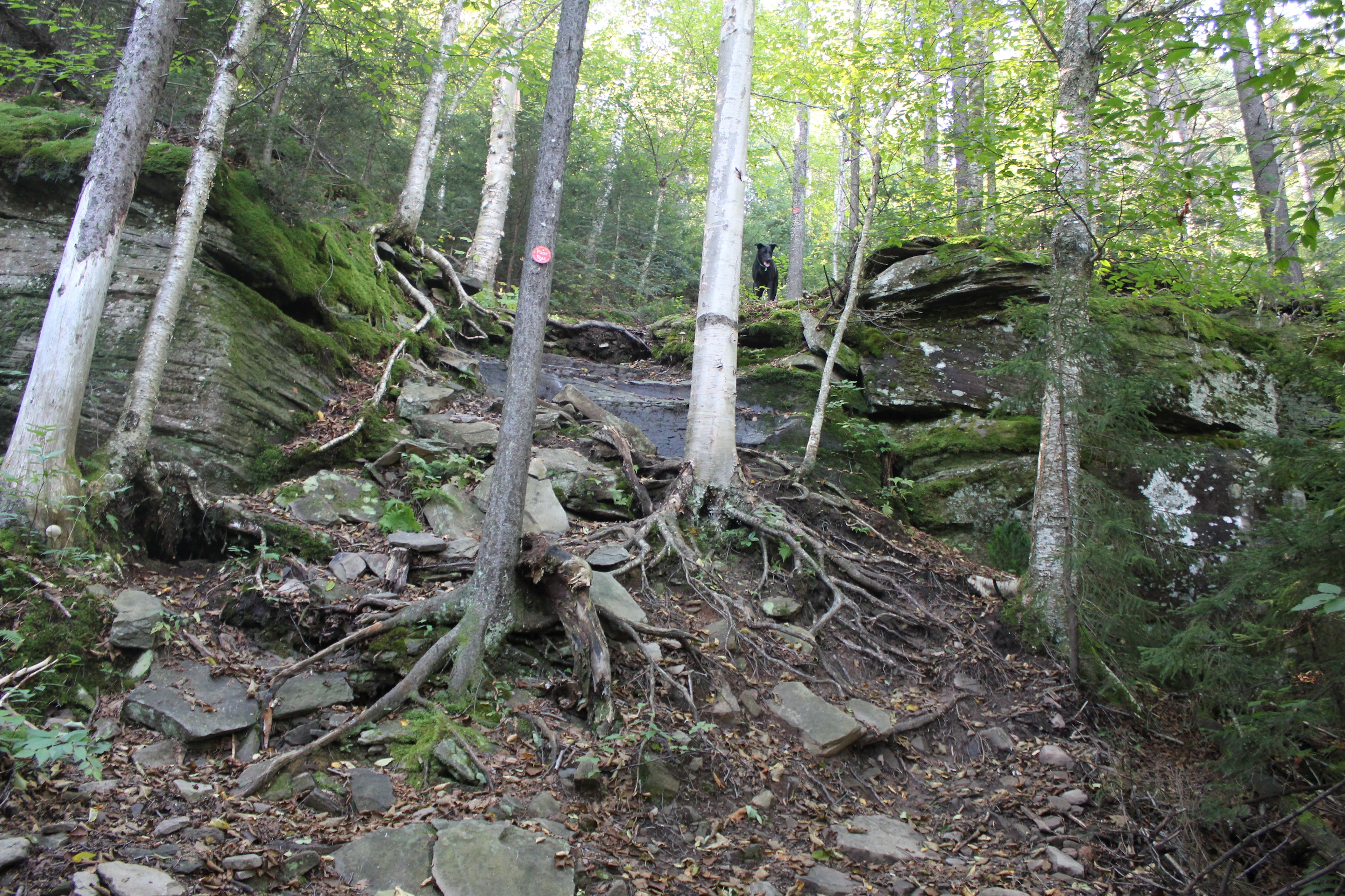
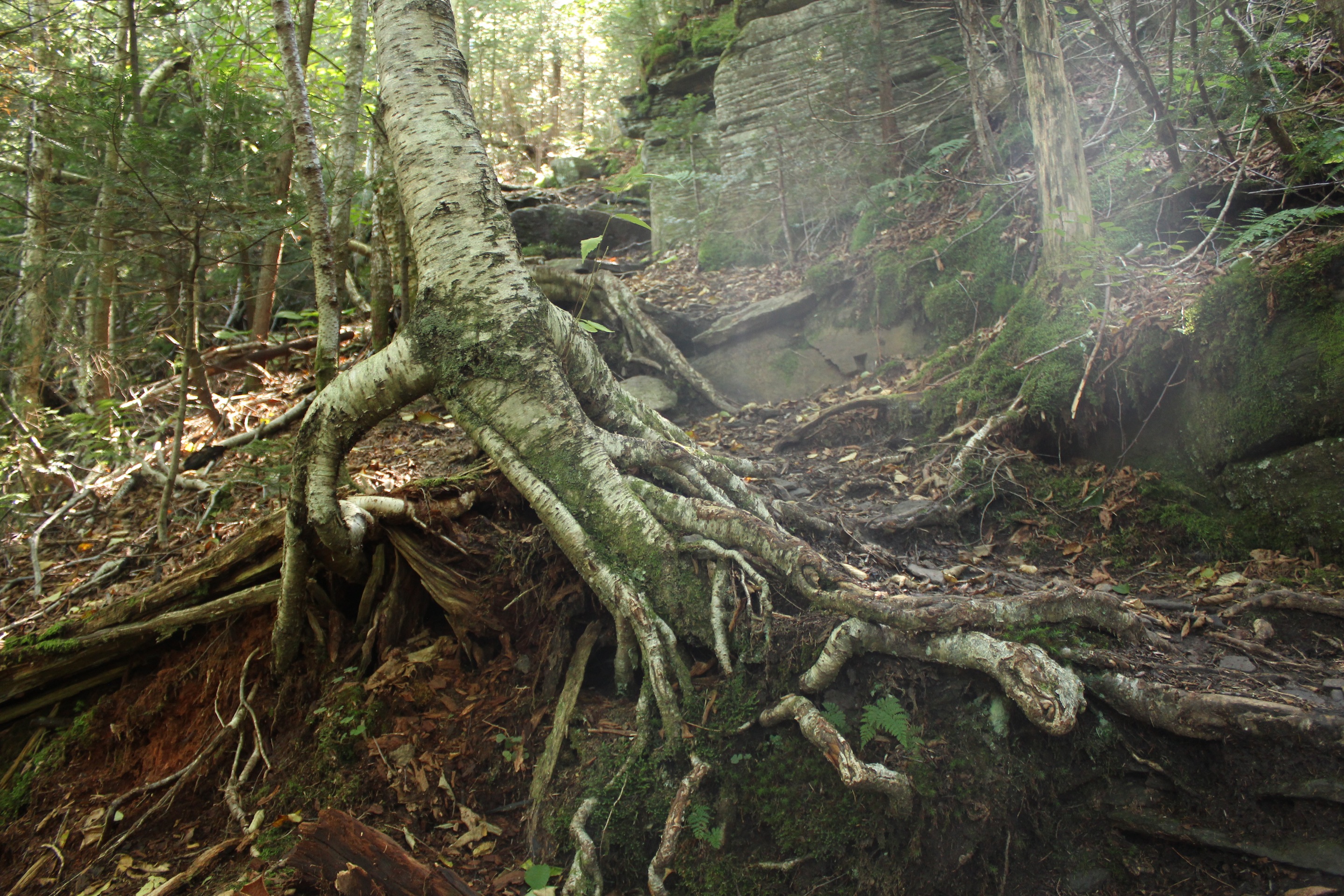
After a pause to watch your Black Labrador puppy almost lose his mind over his first waterfall, sprinting and splashing around like a lunatic, take the bridge over the falls and a sharp right to start the hike to Westkill Summit (blazed red), which will be another 2.23 miles. That leisurely stroll along Diamond Notch was a nice little warm up to get you in the mood, because the ascent to the summit hits you like a 6am step aerobics class. If you need to lose a few pounds Westkill Mountain is the hike for you. It’s a climb: clambering, huffing and puffing. The Devil’s Path has plenty of creeping tree roots, like the earth’s varicose veins, that you can grab, so you can pull yourself over cubist boulders and up sheer rock faces. I remember the rock climber’s mantra: always make sure that three limbs have a firm hold and use the fourth limb to find the next hold. Some of the tree roots are so huge they look like ancient fingers embedded in the path attached to giant, withered hands that had gripped the side of the mountain one last time many eons ago. After 1.4 miles, you arrive at the Rock Overhang, but before that there’s a spring: useful for your dog. Clamber over the Rock Overhang and after a few metres, you notice the smell: an overwhelming mix of earth, fir and spruce that will make you linger. The final half a mile to the summit is a mostly flat, lush evergreen forest with a soft carpet of conifer needles and moss-covered rocks; it looks like an alpine grotto where Santa Claus might take a break. Pause for a moment here to look up at the tops of the conifers piercing the big sky.
The best part of this hike was the discovery of Diamond Notch Falls, a shallow watering hole, thunderously roaring with two waterfalls and plenty of flat shore on which to park yourself post-hike, watch the dog frolic and eat your sandwich. Go to Catskill Mountaineer’s more exact guide to this hike.
* (It was the same on Panther Mountain and, after that hike, I confirmed with two sources that both corroborated the story of the missing summit sign.)
© J.N. Urbanski
© J.N. Urbanski

© J.N. Urbanski
JN, I’ve hiked Diamond Notch many times since my first in the 70’s, and always loved hanging by the falls on a hot summer day. I have great memories of Spruceton Valley and some the old resort hotels that were still operating at the time.
For some reason, I never took the right and up West Kill. I think I thought it was much longer than you described. Anyway, I can’t wait to check it out, some amazing views.
As far as signing in, there used to be a sign in box at the junction of trails right by the falls.
Thanks for all the trail descriptions, really gives a better sense of the trails, as opposed to just reading a map.
Pingback: The Catskill 35 (W): Westkill | UPSTATE DISPATCH