© J.N. Urbanski – Usage prohibited without consent
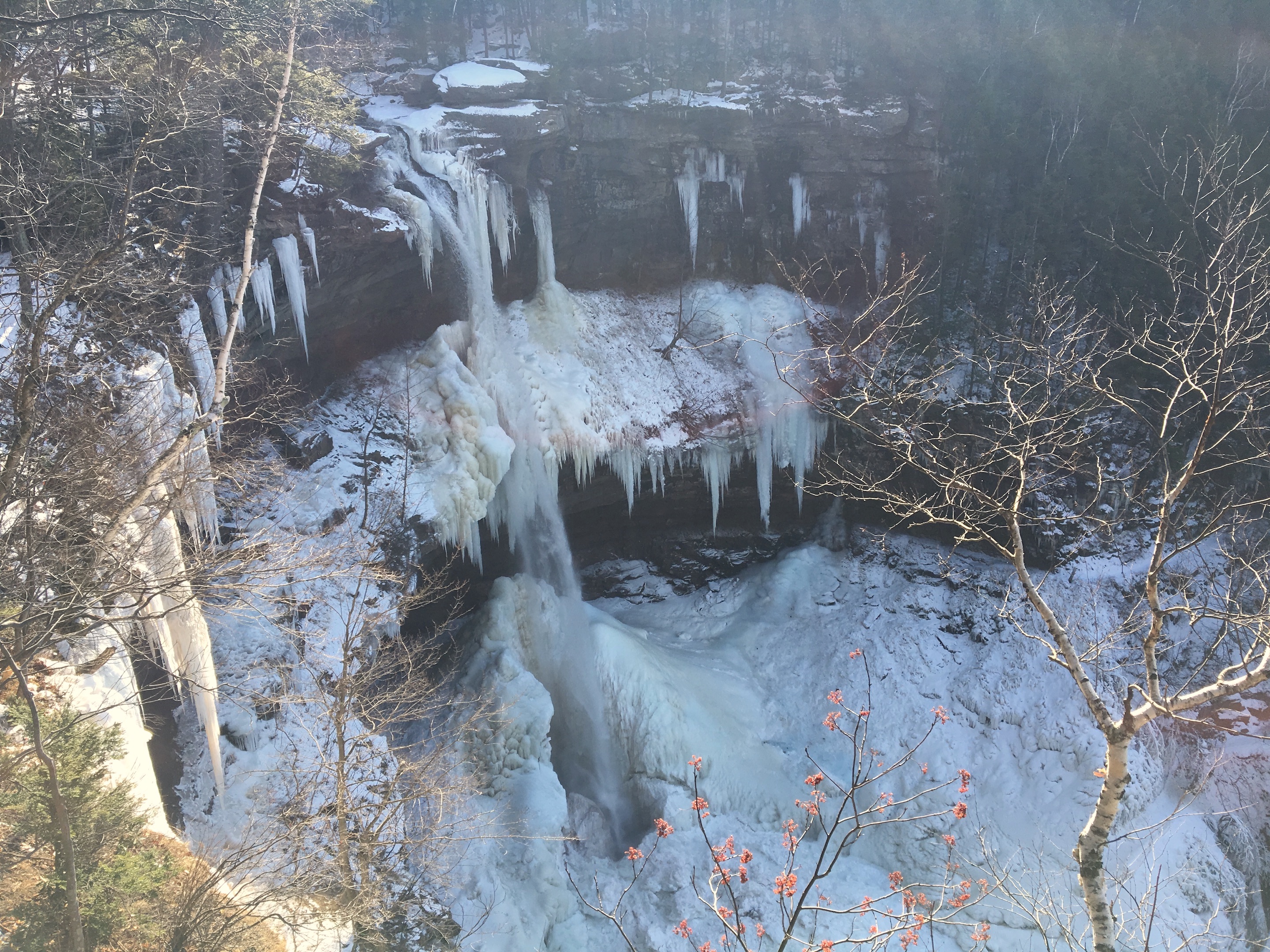
The gloriously gorgeous Kaaterskill Falls, being one of the true wonders of the Catskills, is one of our most popular hiking spots for tourists: lush in the summer and, in winter, haunting the eye with its striking beauty. Because of its popularity, it’s noticeably the most well maintained area, with manmade steps, bridges, a viewing platform, rope handles and much more signage. Most of the signage this season is warning signage because Kaaterskill Falls is also the most dangerous place in the Catskills, statistically speaking. Deaths and injuries occur here every year, mostly because people hike to the top of the waterfall and slip over the edge. To prevent more accidents, a sturdy old-school, farm style fence has been installed at the top of the falls, in addition to plenty of warning signs saying: “danger!”
Despite being so dangerous, these trails are convenient because you can get in some solid, strenuous hiking without having to hike too far into the wilderness and risk becoming isolated, but much care is needed in hiking here, especially now when it’s covered in ice. It’s very steep on the trails around the Falls because the Falls are the highest in New York State at 260ft high and you can hike from the top of the ravine into the bottom or vice versa. Crampons are essential now and don’t bother hiking without them. We passed many people in sneakers, sliding around on the trail, tumbled over or clinging to tree trunks wondering what to do next, but there’s signage telling you not to proceed without the proper gear. Even with crampons, the approach to the bottom of the Falls from the top was treacherous: the long staircase winding down the bottom half of the trail was slick ice and looked like a luge trail. We turned back.
The Falls are situated in the North/South Lake area – south of the Wyndham-Blackhead Range and north of Kaaterskill Wild Forest – and there are so many options for hikes in this area, with many stunning views and landmarks here, that the area has its own insert set into the NYNJ Trail Conference Map (#141). Both the Long Path and the Escarpment Trail go through here. At Upstate Dispatch, we’ve started at the western end of this area – where you’ll find the Falls – and will work our way east, beginning with the parking lot in Haines Falls at the end of the Kaaterskill Rail Trail.
To find the trailhead of the Rail Trail, take Route 23A east though Tannersville and Haines Falls, or west from the I-87 though Palenville. Turn onto North Lake Road, which is just east of Haines Falls and follow the signage to the parking area at the end of the Kaaterskill Rail Trail.
© J.N. Urbanski – Usage prohibited without consent
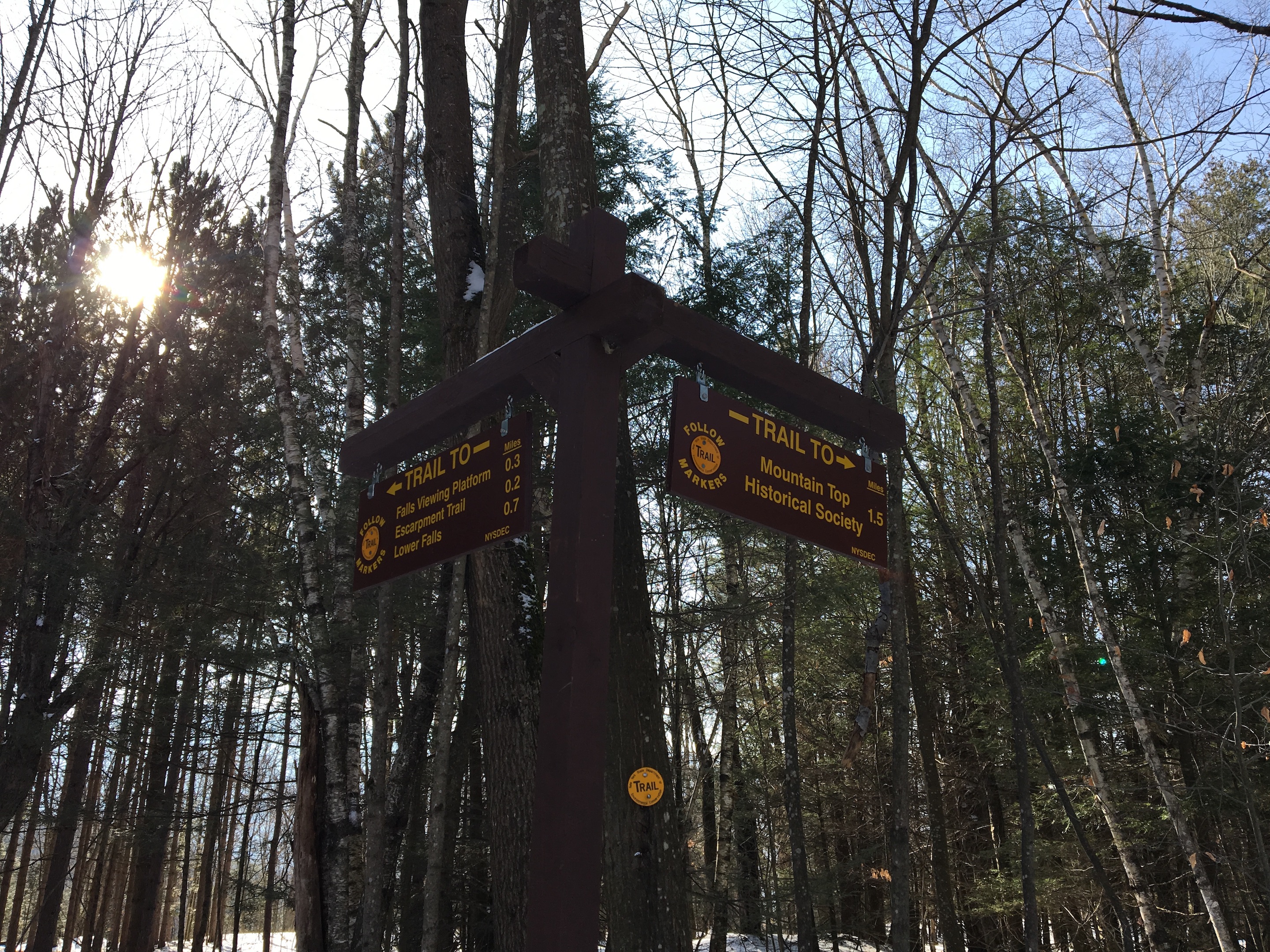
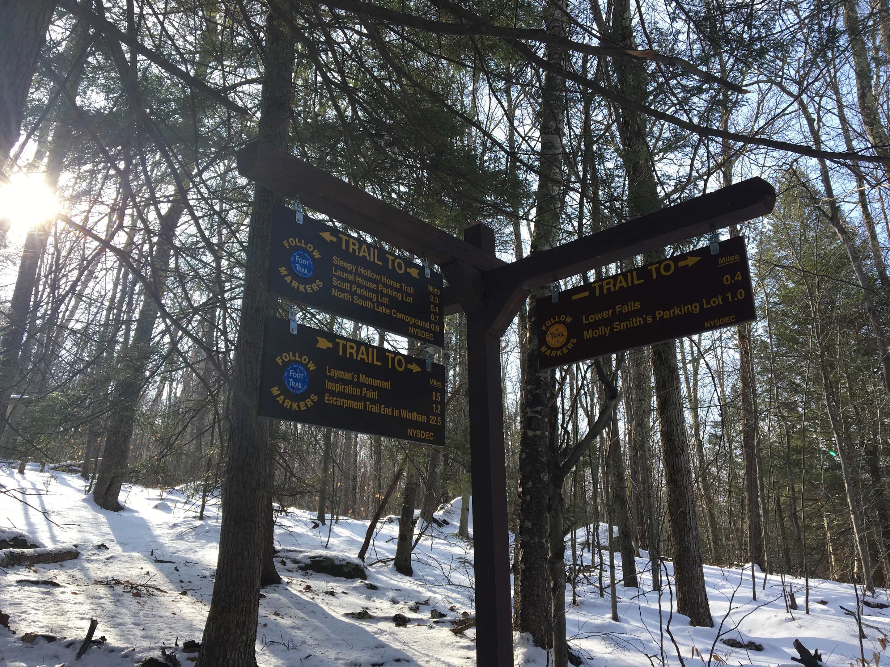
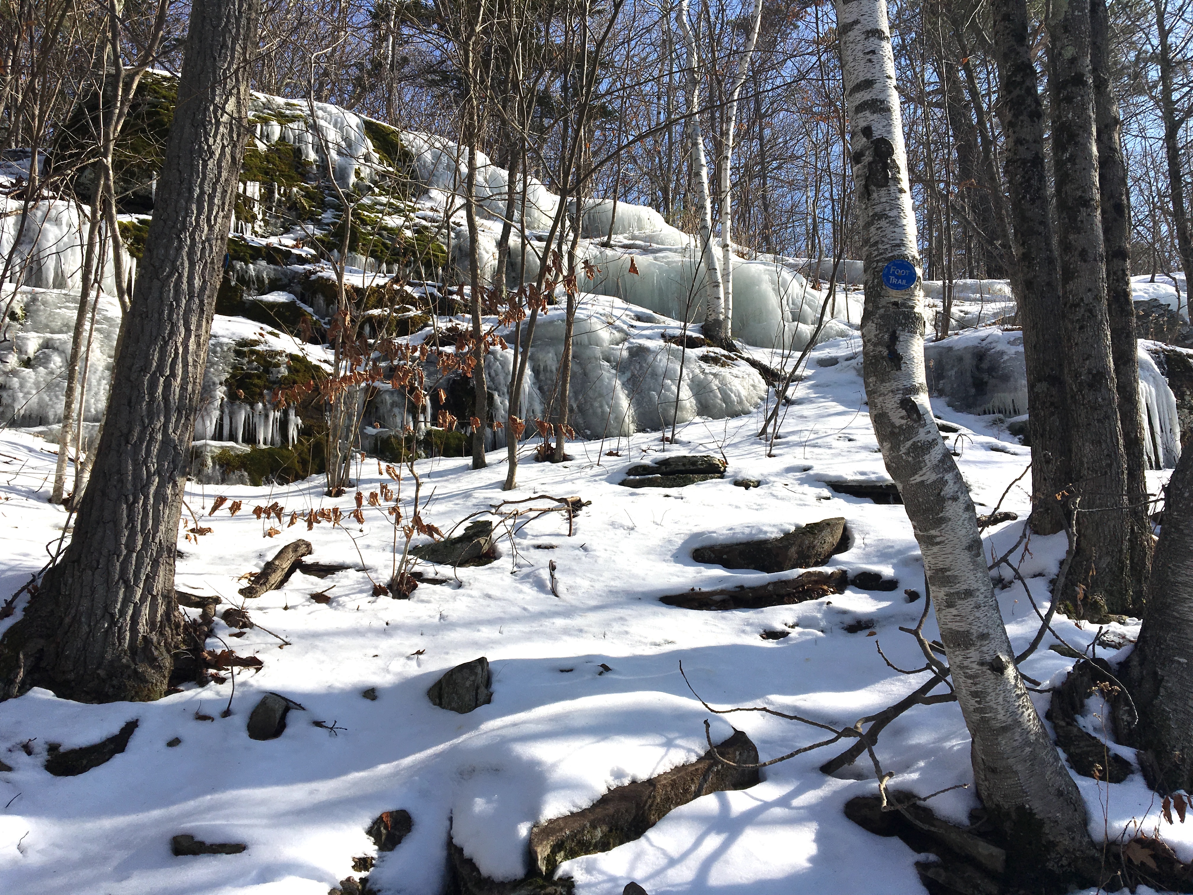
There are two options: walk the Rail Trail to the Historical Society or take the other trail down to the top of Kaaterskill Falls, where you’ll find a viewing platform, a bridge over the top of the Falls and the trail from the top down to the bottom of the Falls, which is pretty treacherous this time of year, as mentioned above. The 2016 map doesn’t make this clear, but the signage (below) does: you can access the blue-blazed Escarpment Trail, the Harding Road trail and beyond from yellow-blazed trail, represented as a dashed red line, from the top of the Falls.
© J.N. Urbanski – Usage prohibited without consent
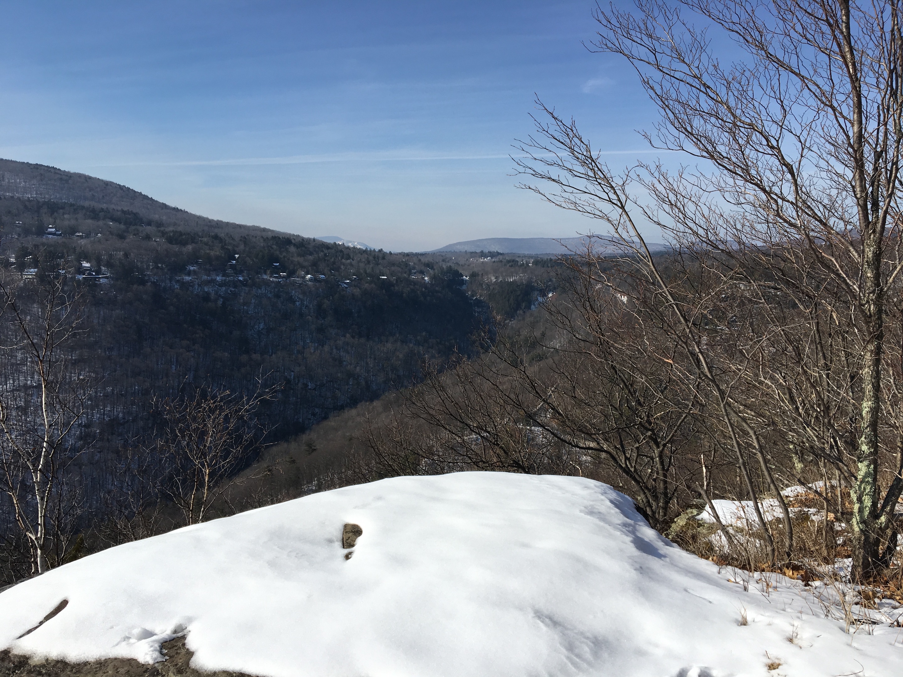
After turning back from the treacherous downwards approach to the Falls, we returned to the viewing platform for stunning views from the top of the Fall. (Go to our Instagram page for video.) Then we circled back to join the blue-blazed Escarpment trail for about a mile or so. There are multiple views from this trail, a memorial for a fallen volunteer fire fighter and places called Sunset Rock and Inspiration Point with gobsmacking views.
© J.N. Urbanski – Usage prohibited without consent
At this point, the iced-over trail gets a bit too close to the edge not to be frightening.
© J.N. Urbanski – Usage prohibited without consent
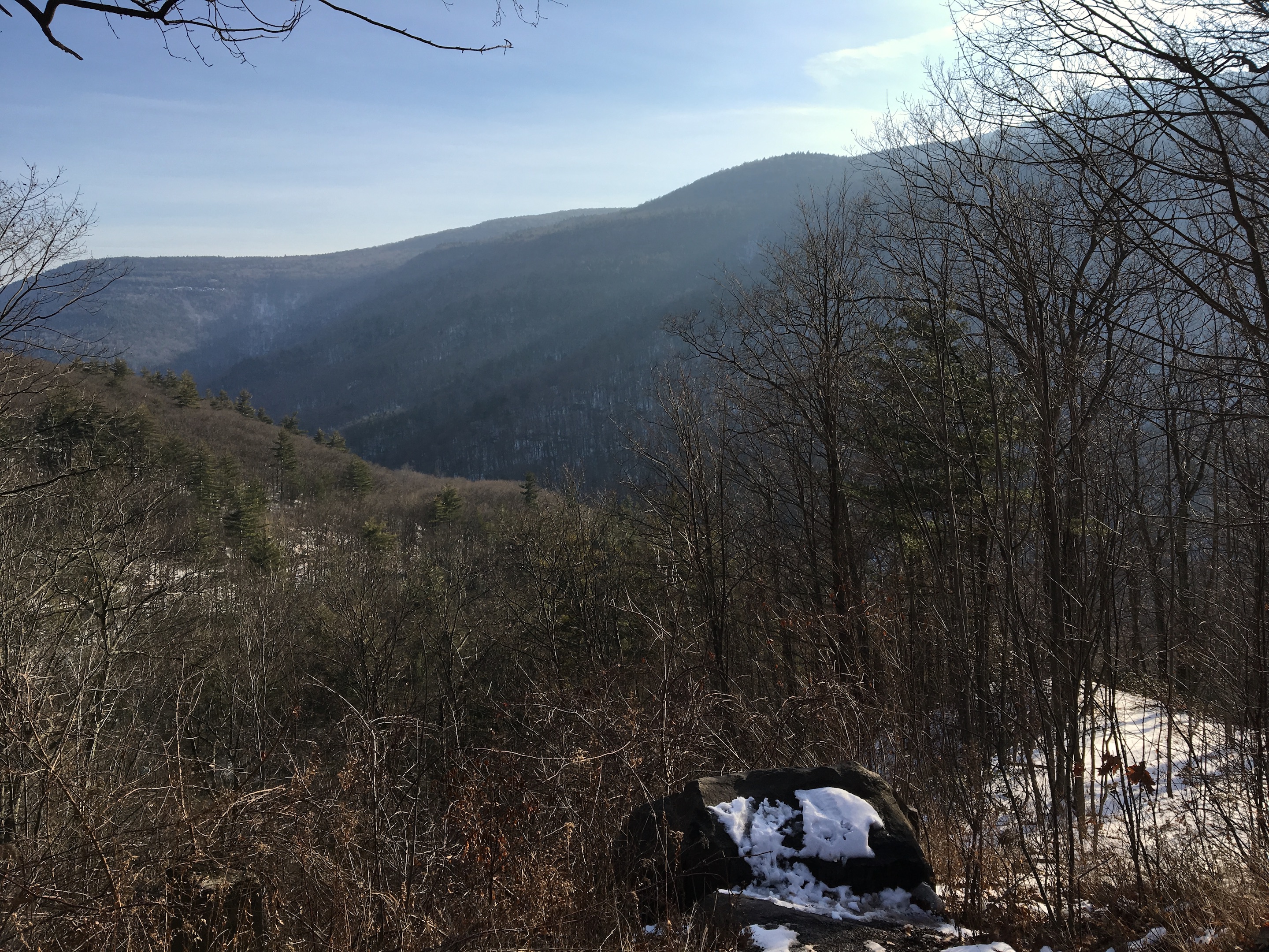
I’ve already slid down one icy mountain and slammed into a tree a year or so ago and was not keen to repeat the experience. So we turned around, returned to the car and drove to the parking area on Route 23A near Bastion Falls, where you’ll find another tribute to Frank Layman, the fallen volunteer fire fighter mentioned above, the spectacular view through Kaaterskill Clove and a historical plaque commemorating the area.
© J.N. Urbanski – Usage prohibited without consent
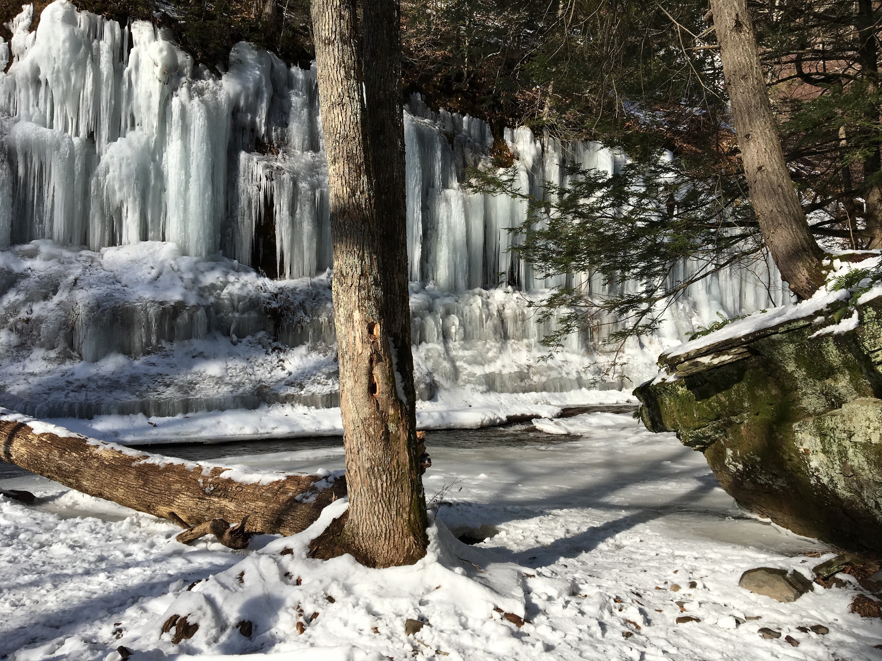
After walking down Route 23A for a few hundred yards (always walk behind the guard rail), we hiked from the bottom of the Falls to the top. This was the most stunning hike of the day in one of the most picturesque valleys in the Catskills, stunningly beautiful, more or less breathtaking at every turn, thick with hemlock trees and covered in a thick mantle of ice and snow. One last thing: beware of falling ice on the opposite side of this trail. Don’t go into the ravine itself for this reason. Stick to the trail.
© J.N. Urbanski – Usage prohibited without consent
Go to Catskill Mountaineer for exact directions on how to hike this trail.