© J.N. Urbanski – Usage prohibited without consent
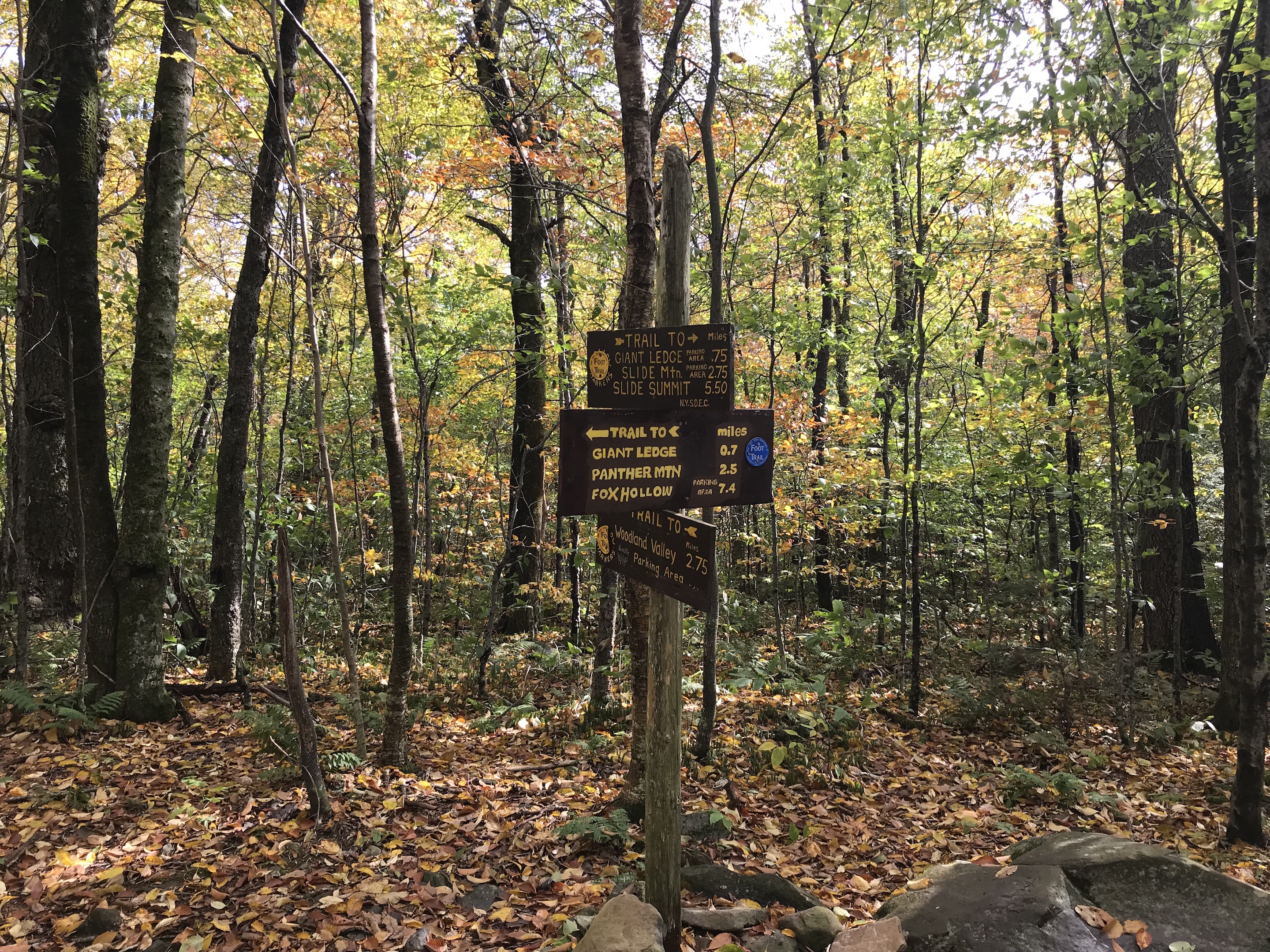
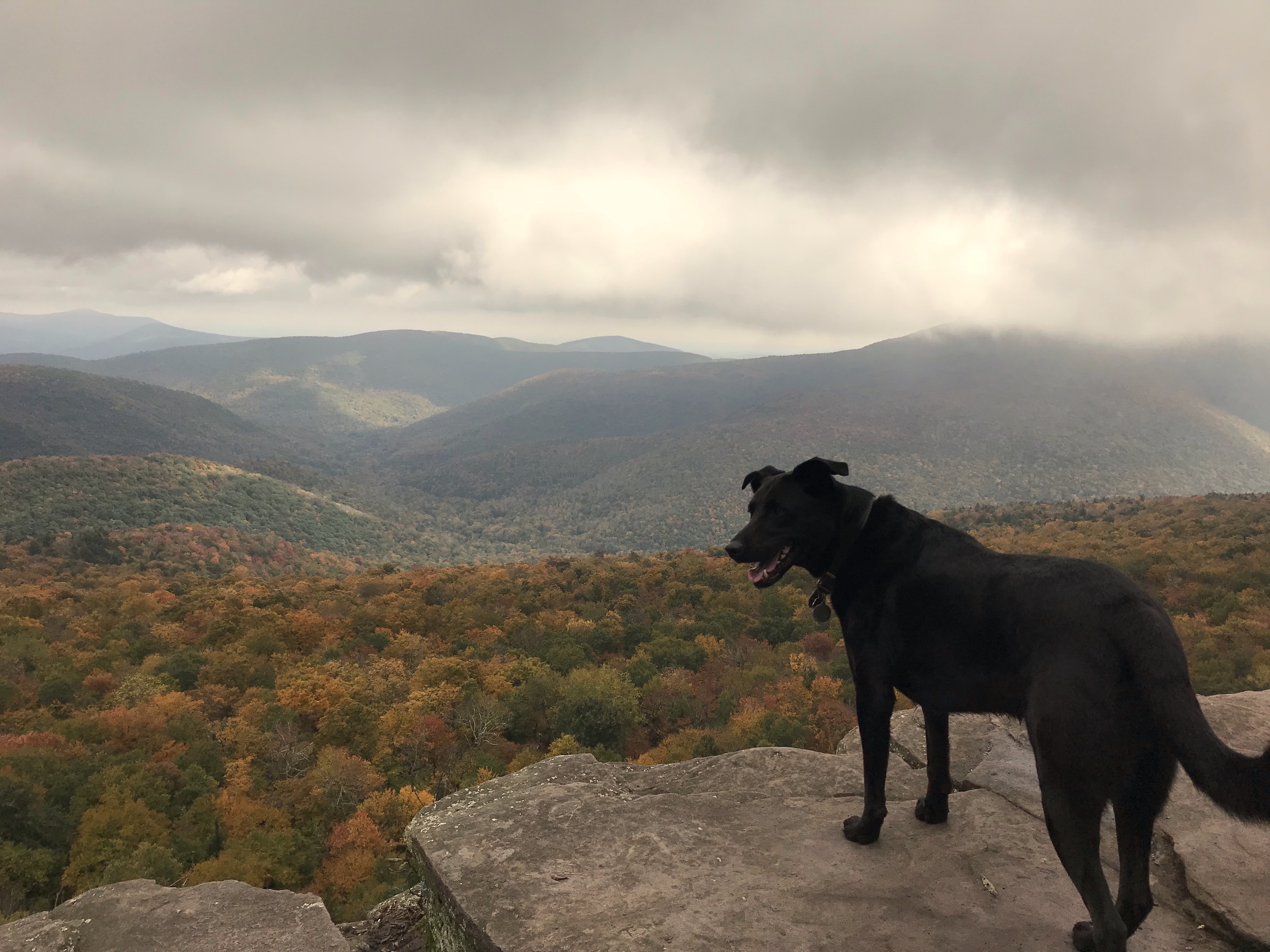
Ah, Giant Ledge. These days it’s like Times Square up there even on a weekday in autumn because it’s a quick 1.5 miles from the parking area, over a babbling brook and up quite a steep, rocky incline to literally a giant ledge jutting out into the wilderness with astonishing panoramic views of both western and eastern Catskill Mountains. On a nice summer day, you can get up there in your day wear on a lunch break and then there’s full cell service at the summit, which makes it popular with the Instagrammers, photographers and weekend visitors. There is no cell service on the way up, in the parking area or on Route 47.
For this reason, Giant Ledge is the gateway hike. It’s lures you in with its easy rewards, and before long, you’ve bought proper hiking shoes, non-cotton clothing and perhaps even hiking poles. If you go 1.85 miles further on from Giant Ledge you will reach the summit of Panther Mountain, which is one of the Catskills peaks over 3500 ft, the “Catskills 35”. (There are 35 peaks over 3500 ft here in the Catskills.)
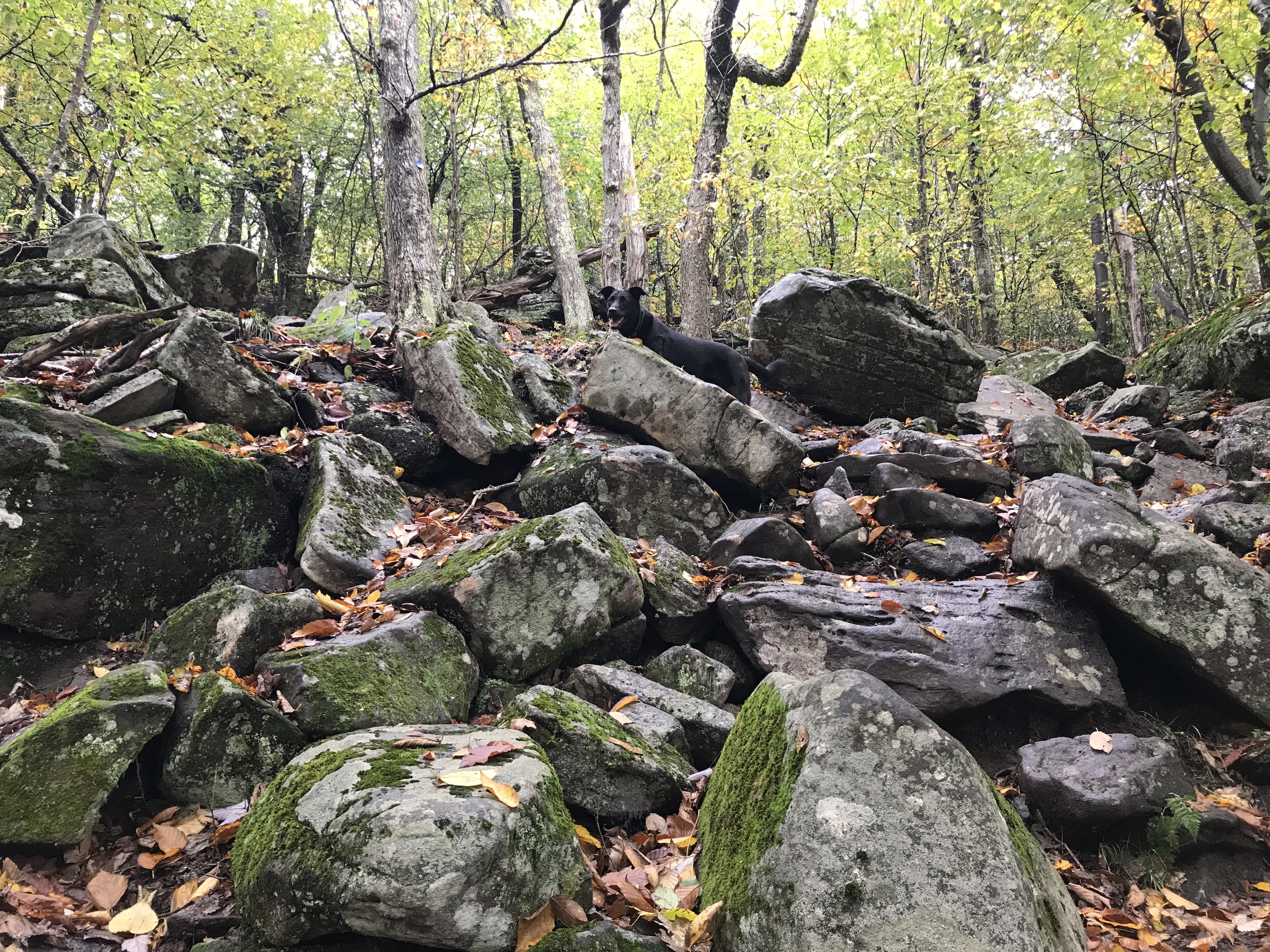
In the fall, it’s muddy and once the leaves start falling on the trail along with the rain, the rocks get very slippery so extra care is needed. (In the winter, it completely ices over and it’s necessary to use crampons). Only the beginning part of the trail to Giant Ledge is level: a brief reprieve in the rock climbing, but it’s still muddy at the moment. None of that seems to deter the multitude of visitors though, because it’s one of the perfect spots to watch the leaves change.
Right now, the landscape is mostly yellow with some swathes of red. There’s lots of green left on the oaks and other hard woods, but it’s sure to burst into its final, vivid orange fireworks any day now. If that happens on a sunny day, we’ll be golden.
Go here to scroll thought last year’s October.
Giant Ledge is a 2.5-hour drive from George Washington Bridge. Take I-87 to Kingston, Exit 19, then take Route 28 (West) after the traffic circle, following the sign to Pine Hill. At Big Indian, turn left onto Route 47 and drive 7.5 miles south on Route 47 until you see the trail head sign. The parking area is just before a hairpin bend.
The View
© J.N. Urbanski – Usage prohibited without consent
The Trail
© J.N. Urbanski – Usage prohibited without consent