
© MAU
Senseless vandalism in the form of tree gouging has been taking place on several of our Catskills 35 bushwhacks in the past month shocking local hikers. Polite members of the Catskills hiking community are calling the hand-sized marks “blazing”, but they are not just your average grazing or marking of the bark with a pocket knife. They are distinct, deliberate, firmly removed chunks of tree that are a couple of tree-rings deep, accomplished expertly with a well-sharpened tool. On one bushwhack, hikers reported as many as 50 trees affected, so sadly, it looks like hikers doing the trail-less peaks have been marking their way by chopping at the trees like lumberjacks gone rogue.
The whole episode seems like it was an organized exercise or competition of some kind. Let’s hope it was a one-off, if so, because if this practice continues unabated who knows where it could lead.
For those sporting GPS navigation who think a map and compass is as old-school as a typewriter, along comes a halfwit(s) with an axe to prove them wrong. These events make for an unnerving twist of my quest to complete the Catskills 35. I only have the bushwhacks left to go on my Catskills 35 List but I’m now thinking about security against axe-wielders and am only sort of half-joking. I’m wondering if I should start a bushwhack group, which sounds like The Blue Man Group for country folk. We could paint ourselves entirely green and creep our way around the Catskills, with our eyes wide, paying rapt attention to the wilderness, silently avoiding the crazy-blazer like proper tree people.
This gouging hasn’t happened on the west side of Graham Mountain, because, although Graham is a bushwhack, it’s at the summit of a very clearly trodden path and needs no marking. However, a pest of a different sort is taking out the trees at an alarming rate on this trail: the Emerald Ash Borer was in full effect on the unmarked trail and had downed one tree.
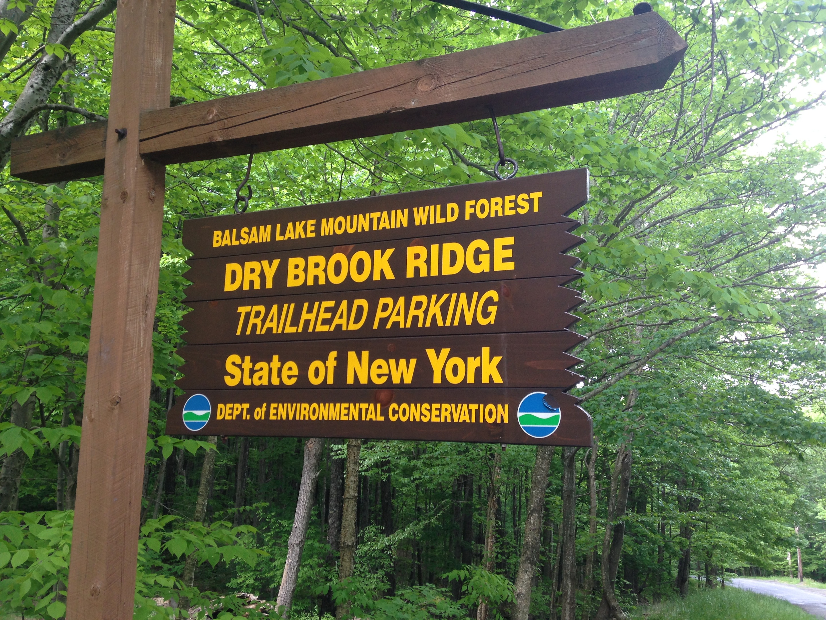
There are several ways to approach Graham Mountain, but the easiest is to park at the Mill Brook parking area and join the middle of the Dry Brook Ridge trail and hike south on the blue-blazed trail, as if you’re going to Balsam Lake Mountain. Many avid hikers do both Balsam Lake and Graham in one day. The unmarked turn to Graham is about 2.2 miles towards Balsam Lake on the Dry Brook Ridge trail, at which point you take this unmarked trail that is a switch back and takes a sharp turn towards the east. The path appears as a dotted red line on the map as is about 2.5 miles to the summit but is not blazed. As mentioned by Catskill Mountaineer here, this turn off to Graham is easy to miss, but it’s easy to know if you’ve gone too far when you reach the next mile markers that are a short distance farther. If you do miss it, the Y-shaped turn will be apparent when you are walking north again (pictured below).

© J.N. Urbanski
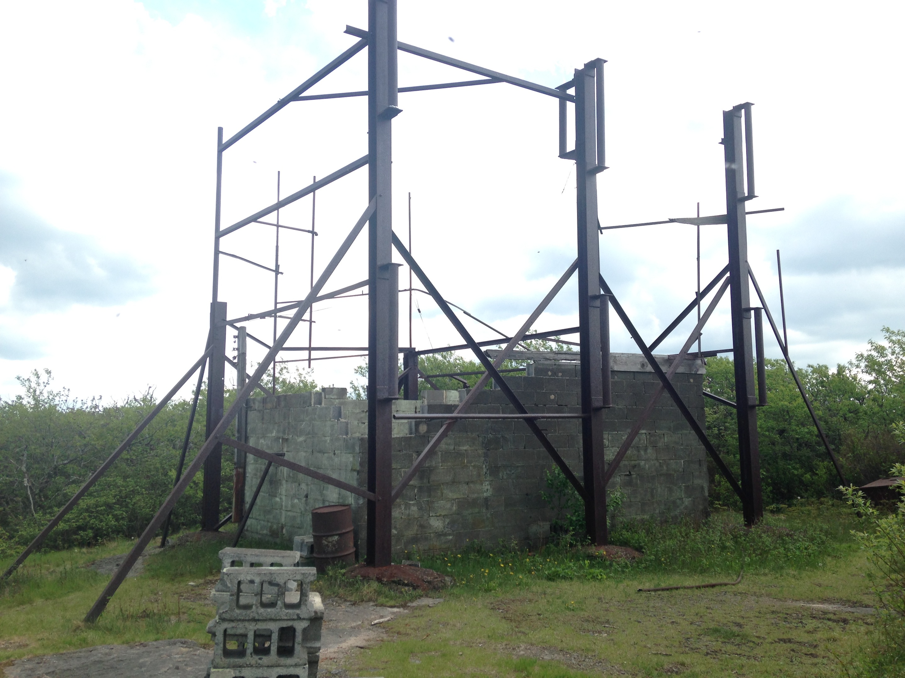
This hike is a long and steady incline, with flat sections, that seems gentle, but just because there’s no climbing involved doesn’t mean it’s not tough on the thighs. The path is mostly dirt, but in some sections the going is covered with small, loose rocks to trip over if you’re suffering fatigue-induced clumsiness on the way down. Views that were probably much clearer in the winter provide glimpses of green, and there’s a well worn, obvious side trail off to the north that will provide a view about half a mile from the summit. The summit is a surprisingly small area filled with the shell of a burned out fire tower.

© J.N. Urbanski
© J.N. Urbanski